Continents and Oceans Escape Room: Name Them on the Map
by Creouts Publishing © 2026
Price: $3 USD
Subjects: socialstudies,geography
Grades: 3,4,5
Description
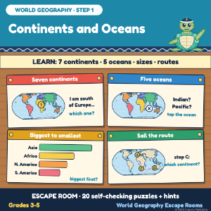
Students learn and practise: the 7 continents and 5 oceans on a world map, which continent or ocean is where, sizes from biggest to smallest, and reading a sea route (Grade 3-5 level). STEP 1 of World Geography: Continents, Capitals, Biomes Escape Rooms (7 escape rooms, bundle 20% off). Story: the ship Wavelark sails round the world to finish the Big Atlas; Marlo the sea turtle helps open a chart chest. 4 rooms, 30 cards. HOW IT WORKS - Room 1: continents on plain and coloured maps, riddles, outlines. - Room 2: the ocean between two continents, around Antarctica. - Room 3: sizes: about 3 times as big, the ocean bigger than all the land. - Room 4: a voyage with stops A to E: continents, oceans, counting. SELF-CHECKING WITH HINTS 8 typed, 7 tile and 4 tap answers plus the lock. A learn card opens each room; two hints per puzzle. ACCURACY Real map data on an equal-area map. Software re-reads every card and re-checks every answer against the raw map data and the fact sources. Solved from the cards alone by separate AI test sessions. Not tested with a class. SOURCES Natural Earth map data (public domain); CIA World Factbook (archived 2026 data); NOAA Ocean Service (five oceans); C3 Framework for Social Studies, Geography D2.Geo.1.3-5 and D2.Geo.2.3-5 (no copied text). HOW IT WAS MADE Text written with AI help and checked. Pictures and maps drawn in code. Needs internet. For learning only. The ship, the crew and the town are made up. Map: Natural Earth (public domain).
Acknowledgements
Text fonts: Atkinson Hyperlegible, (c) Braille Institute of America, SIL Open Font License 1.1; Fredoka, (c) The Fredoka Project Authors, SIL Open Font License 1.1.