Choosing the Shortest Route: Map Skills Escape Room
by Creouts Publishing © 2026
Price: $3 USD
Subjects: socialstudies,geography
Grades: 4,5,6
Description
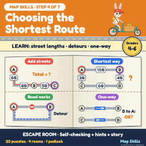
Students learn and practise: street lengths on a map, route totals, comparing routes, the shortest way, detours, one-way streets and the best order for several stops (Grade 4-6 level). STEP 4 of Map Skills: Compass, Grids, Scale and Routes (7 escape rooms, bundle 20% off). The story: in Tockridge, a made-up hill town, it is road works day. Streets are closed and the hill streets are one-way. Ms. Pilar left the fair pass for Pip the rabbit's cargo bike in a route box. 4 rooms, 4 code digits, 1 padlock. 30 cards, 20 scored. HOW IT WORKS - Room 1 Thimble Row: street lengths, route totals, the shortest way (not to scale). - Room 2 Bellbridge Canal: CLOSED signs, bridges over a canal, detours. - Room 3 Weathervane Hill: one-way streets, the turn at a corner, the way back. - Room 4 Orchard Lanes: 2 and 3 stops, the best order, a round trip; the padlock. SELF-CHECKING WITH HINTS - 7 typed answers, 4 taps on the map, 9 tile answers; Boom scores each one. - Two hints per puzzle: a method, then a closer nudge. ACCURACY Software re-reads every card and recomputes every answer from the maps. Not tested with a class. SOURCES England National Curriculum, geography KS2: use maps and digital/computer mapping. NCSS C3 Framework D2.Geo.1.3-5. All places are made up. HOW IT WAS MADE Text written with AI help and checked. Maps and pictures drawn in code. Needs internet.
Acknowledgements
Text fonts: Atkinson Hyperlegible, (c) Braille Institute of America, SIL Open Font License 1.1; Fredoka, (c) The Fredoka Project Authors, SIL Open Font License 1.1.