Latitude and Longitude Coordinates: Map Skills Escape Room
by Creouts Publishing © 2026
Price: $3 USD
Subjects: socialstudies,geography
Grades: 5,6
Description
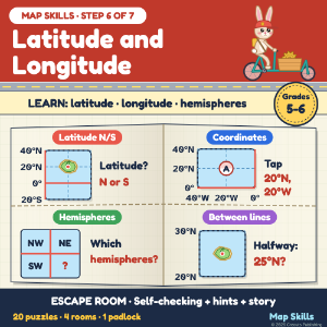
Students learn and practise: the equator and prime meridian, reading latitude (N/S) and longitude (E/W), writing coordinates latitude first, hemispheres, sailing across 0°, places halfway between lines, and the poles (Grade 5-6 level). STEP 6 of Map Skills: Compass, Grids, Scale and Routes (7 escape rooms, bundle 20% off). The story: in Tockridge, a made-up hill town, the Clock Tower's new gear needs its brass case. Captain Wynn brings it by ferry. First she trains Pip the rabbit and the students on her practice chart of made-up islands. 4 rooms, 4 code digits, 1 padlock. 20 scored puzzles. HOW IT WORKS - Room 1 Harbour Steps: the equator, latitude 0° to 90° N or S. - Room 2 Wynn's Map Room: the prime meridian, longitude 0° to 180° E or W, coordinates. - Room 3 Lighthouse Pier: hemispheres, sailing N, S, E and W across 0°. - Room 4 Ferry Deck: halfway between lines (25°N), the poles, a 3-leg trip, the padlock. SELF-CHECKING WITH HINTS - 7 typed answers (20N 40W works), 6 taps on the chart, 7 tile answers; Boom scores each one. - Two hints per puzzle: a method, then a nudge. ACCURACY Software re-reads every card and recomputes every answer from the charts. Not tested with a class. SOURCES England National Curriculum, geography KS2: latitude, longitude, Equator, Prime/Greenwich Meridian. NCSS C3 Framework D2.Geo.1.3-5. All islands and places are made up. HOW IT WAS MADE Text written with AI help and checked. Maps and pictures drawn in code. Needs internet.
Acknowledgements
Text fonts: Atkinson Hyperlegible, (c) Braille Institute of America, SIL Open Font License 1.1; Fredoka, (c) The Fredoka Project Authors, SIL Open Font License 1.1.